📰
NewzReport
Read here first · then visit the publisher
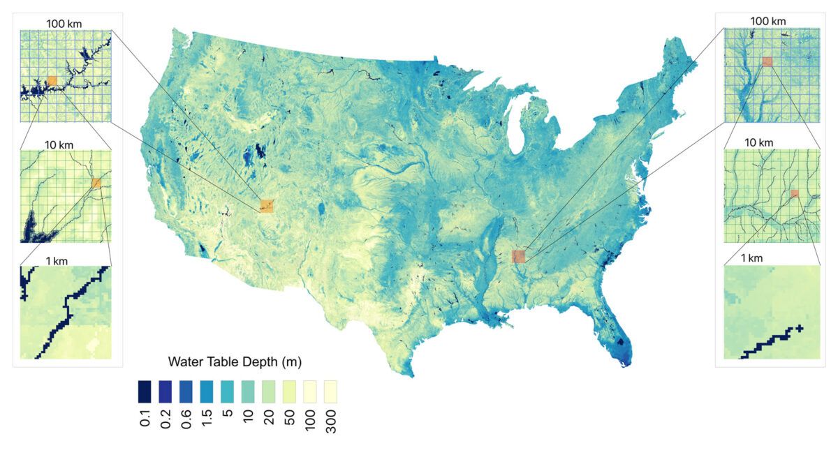
There's 13 Great Lakes' worth of water hidden beneath the contiguous US, new map reveals
Combining direct measurements with artificial intelligence methods, a new map estimates groundwater depth across the contiguous United States at a resolution of around 30 meters. Researchers used 1 million data points and a machine learning algorithm to estimate groundwater stores with higher resolution than ever before.
Researchers used 1 million data points and a machine learning algorithm to estimate groundwater stores with higher resolution than ever before.